Zastávky v okolí
Gaweinstal Gemeindeamt ¤,
Gaweinstal Gemeindeamt ¤,
Gaweinstal Hauptplatz ¤,
Gaweinstal Volksschule ¤,
Gaweinstal Hauptplatz ¤,
Gaweinstal Volksschule ¤,
Gaweinstal Wiener Straße ¤,
Gaweinstal Martinsdorferstraße ¤,
Gaweinstal Brünner Straße ¤,
Gaweinstal Martinsdorferstraße ¤,
Gaweinstal Brünner Straße ¤,
Gaweinstal Wiener Straße ¤MHD v okolí
Bus 500: Schrick Hobersdorfer Straße = > Wien Floridsdorf ¤,
Bus 571: Mistelbach Bahnhof = > Martinsdorf Winzerstraße ¤,
Bus 535: Gänserndorf Bahnhof = > Mistelbach Bahnhof ¤,
Bus 571: Mistelbach Alleegasse = > Klein-Harras Hauptstraße ¤,
Bus 571: Gaweinstal Hauptplatz = > Mistelbach Alleegasse = > Mistelbach Bahnhof ¤,
Bus 571: Pellendorf Feuerwehr = > Martinsdorf Winzerstraße = > Gaweinstal Volksschule ¤,
Bus 571: Gaweinstal Volksschule = > Bad Pirawarth Untere Hauptstraße ¤,
Bus 571: Schrick = > Gaweinstal = > Höbersbrunn = > Mistelbach Bahnhof ¤,
Bus 571: Gaweinstal Hauptplatz = > Mistelbach Bahnhof ¤,
Bus 571: Höbersbrunn Obere Landstraße = > Gaweinstal Hauptplatz ¤,
Bus 500: Wien Floridsdorf = > Mistelbach Bahnhof ¤Viac o bode
Viac info:
aktualizovať mapu,
uprav v JOSM (pokročilé),
29435946,
stiahni GPX,
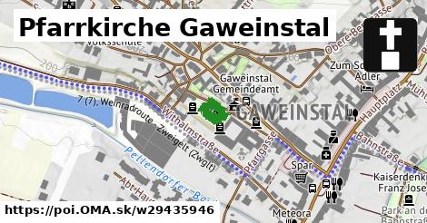
wikidata, fixme: Lage und Details, miesto pre bohoslužby, building: church, heritage: 2, religion: christian, addr:city: Gaweinstal, wikipedia: de:Pfarrkirche Gaweinstal, addr:country: AT, denomination: roman catholic, addr:postcode: 2191, bda, lon: 16.587558061894224, lat: 48.4779627438614, og type: place,
Zdroj dát
Mapové údaje pochádzajú z
www.OpenStreetMap.org, databáza je prístupná pod licenciou
ODbL.

Mapový podklad vytvára a aktualizuje
Freemap Slovakia (www.freemap.sk), šíriteľný pod licenciou CC-BY-SA. Fotky sme čerpali z galérie portálu freemap.sk, autori fotiek sú uvedení pri jednotlivých fotkách a sú šíriteľné pod licenciou CC a z wikipédie. Výškový profil trás čerpáme z
SRTM. Niečo vám chýba?
Pridajte to. Sme radi, že tvoríte slobodnú wiki mapu sveta.