MHD v okolí
Bus 277: Bruck an der Leitha Volksschule = > Wilfleinsdorf Kirche = > Eisenstadt Domplatz ¤,
Bus 248: Enzersdorf an der Fischa Volksschule = > Gramatneusiedl Bahnhof ¤,
Bus 277: Sommerein Kirchenplatz = > Eisenstadt Domplatz ¤,
Bus 248: Schwadorf Schulgasse = > Reisenberg Hermannstadtstraße = > Gramatneusiedl Bahnhof ¤,
Bus 277: Mannersdorf am Leithagebirge Hauptstraße = > Eisenstadt Domplatz ¤,
Bus 277: Bruck an der Leitha Neue Mittelschule = > Mannersdorf am Leithagebirge Volksschule ¤,
Bus 277: Bruck an der Leitha Volksschule = > Eisenstadt Domplatz ¤,
Bus 277: Stotzing Ortsmitte = > Bruck an der Leitha Neue Mittelschule ¤,
Bus 248: Gramatneusiedl Bahnhof = > Reisenberg Hermannstadtstraße = > Enzersdorf an der Fischa Volksschule ¤,
Bus 247: Götzendorf Bahnhof = > Au am Leithaberge Hauptplatz ¤,
Bus 277: Mannersdorf am Leithagebirge Hauptstraße = > Eisenstadt Oberberg ¤Viac o bode
Viac info:
aktualizovať mapu,
uprav v JOSM (pokročilé),
98640691,
stiahni GPX,
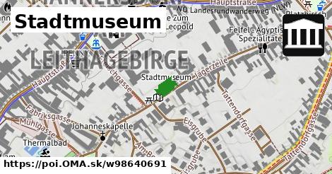
wikidata, múzeum, website: https://www.stadtmuseummannersdorf.at/, building: yes, addr:city: Mannersdorf am Leithagebirge, wikipedia: de:Schüttkasten Mannersdorf am Leithagebirge, addr:street: Jägerzeile, addr:postcode: 2452, opening hours: May Oct: Su 10:00 12:00, 9, lon: 16.605532959195195, lat: 47.973244847629545, og type: place, og locality: Gemeinde Mannersdorf am Leithagebirge,
Zdroj dát
Mapové údaje pochádzajú z
www.OpenStreetMap.org, databáza je prístupná pod licenciou
ODbL.

Mapový podklad vytvára a aktualizuje
Freemap Slovakia (www.freemap.sk), šíriteľný pod licenciou CC-BY-SA. Fotky sme čerpali z galérie portálu freemap.sk, autori fotiek sú uvedení pri jednotlivých fotkách a sú šíriteľné pod licenciou CC a z wikipédie. Výškový profil trás čerpáme z
SRTM. Niečo vám chýba?
Pridajte to. Sme radi, že tvoríte slobodnú wiki mapu sveta.

 Mapový podklad vytvára a aktualizuje Freemap Slovakia (www.freemap.sk), šíriteľný pod licenciou CC-BY-SA. Fotky sme čerpali z galérie portálu freemap.sk, autori fotiek sú uvedení pri jednotlivých fotkách a sú šíriteľné pod licenciou CC a z wikipédie. Výškový profil trás čerpáme z SRTM. Niečo vám chýba? Pridajte to. Sme radi, že tvoríte slobodnú wiki mapu sveta.