MHD v okolí
Bus 275: Hainburg an der Donau Landesklinikum = > Bruck an der Leitha Neue Mittelschule (über Hundsheim bei Hainburg Am Hohlweg, nicht über Deutsch Haslau Obere Hauptstraße und Bruck an der Leitha Eco-Plus-Park 2.Straße) ¤,
Bus 275: Hainburg an der Donau Landesklinikum = > Petronell Schaffelhof = > Bruck an der Leitha Bahnhof ¤,
Bus 275: Hainburg an der Donau Josef-Maurer-Gasse = > Bad Deutsch-Altenburg Badgasse = > Petronell Schaffelhof = > Bruck an der Leitha Bahnhof ¤,
Bus 274: Hainburg an der Donau Landesklinikum = > Bruck an der Leitha Bahnhof ¤,
Bus 275: Hainburg an der Donau Landesklinikum = > Petronell Schaffelhof ¤,
Bus 275: Bruck an der Leitha Gymnasium/HAK = > Petronell Schaffelhof = > Hainburg an der Donau Landesklinikum ¤,
Bus 275: Hainburg an der Donau Josef-Maurer-Gasse = > Bruck an der Leitha Gymnasium/HAK ¤,
Bus 275: Hainburg an der Donau Hauptplatz = > Hundsheim bei Hainburg Am Hohlweg = > Potzneusiedl Untere Hauptstraße ¤,
S7: Wolfsthal = > Mistelbach ¤,
Bus 274: Hainburg an der Donau Ungartor/B9 = > Bruck an der Leitha Bahnhof ¤,
Bus 274: Hainburg an der Donau Hauptplatz = > Bruck an der Leitha Bahnhof ¤Viac o bode
Viac info:
aktualizovať mapu,
uprav v JOSM (pokročilé),
106136518,
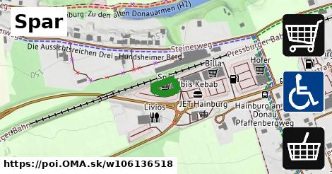
stiahni GPX, ele2: 168.35114, supermarket, brand: Spar, website: https://www.spar.at/, building: retail, addr:city: Hainburg an der Donau, check date: 2024 09 03, wheelchair: yes, addr:street: Landstraße, roof:levels: 0, payment:cash: yes, payment:visa: yes, addr:postcode: 2410, opening hours: Mo Fr 07:15 19:30; Sa 07:15 18:00, brand:wikidata: Q610492, building:levels: 1, payment:maestro: yes, 124, yes, yes, lon: 16.918386725086975, lat: 48.14024608488144, og type: place, og locality: Gemeinde Hainburg an der Donau,
Zdroj dát
Mapové údaje pochádzajú z
www.OpenStreetMap.org, databáza je prístupná pod licenciou
ODbL.

Mapový podklad vytvára a aktualizuje
Freemap Slovakia (www.freemap.sk), šíriteľný pod licenciou CC-BY-SA. Fotky sme čerpali z galérie portálu freemap.sk, autori fotiek sú uvedení pri jednotlivých fotkách a sú šíriteľné pod licenciou CC a z wikipédie. Výškový profil trás čerpáme z
SRTM. Niečo vám chýba?
Pridajte to. Sme radi, že tvoríte slobodnú wiki mapu sveta.

 Mapový podklad vytvára a aktualizuje Freemap Slovakia (www.freemap.sk), šíriteľný pod licenciou CC-BY-SA. Fotky sme čerpali z galérie portálu freemap.sk, autori fotiek sú uvedení pri jednotlivých fotkách a sú šíriteľné pod licenciou CC a z wikipédie. Výškový profil trás čerpáme z SRTM. Niečo vám chýba? Pridajte to. Sme radi, že tvoríte slobodnú wiki mapu sveta.