MHD v okolí
Bus 530: Gänserndorf Bahnhof = > Auersthal Europa-Siedlung = > Wolkersdorf Wiener Straße ¤,
Bus 531: Gänserndorf Bahnhof = > Wolkersdorf Bahnhof ¤,
Bus 531: Wolkersdorf Mittelschule = > Großengersdorf Rochusgasse ¤,
Bus 531: Wolkersdorf Volksschule = > Reyersdorf Hauptstraße ¤,
Bus 530: Wolkersdorf Wiener Straße = > Gänserndorf Bahnhof ¤,
Bus 531: Wolkersdorf Mittelschule = > Wolkersdorf Gymnasium = > Großengersdorf Rochusgasse ¤,
Bus 531: Großengersdorf Rochusgasse = > Wolkersdorf Gymnasium ¤,
Bus 531: Wolkersdorf Mittelschule = > Auersthal Schulen ¤,
Bus 530: Gänserndorf Bahnhof = > Wolkersdorf Wiener Straße ¤,
Bus 531: Wolkersdorf Bahnhof = > Auersthal Am Anger ¤,
Bus 531: Wolkersdorf Gymnasium = > Gänserndorf Bahnhof ¤Viac o bode
Viac info:
aktualizovať mapu,
uprav v JOSM (pokročilé),
1035311656,
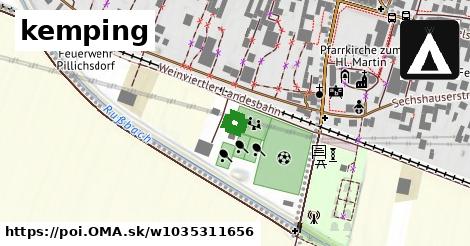
stiahni GPX, charge: 15 EUR, shower: yes, toilets: yes, autokemping, website: https://pillichsdorf tennis.jimdofree.com/camping/, caravans: yes, reservation: no, water point: yes, caravan site: motorhome stopover, power supply: yes, services:fee: yes, services:charge: 15 EUR/water point, sanitary dump station, toilets, shower, no, sports centre, yes, lon: 16.537400213633394, lat: 48.36161561728977, og type: place,
Zdroj dát
Mapové údaje pochádzajú z
www.OpenStreetMap.org, databáza je prístupná pod licenciou
ODbL.

Mapový podklad vytvára a aktualizuje
Freemap Slovakia (www.freemap.sk), šíriteľný pod licenciou CC-BY-SA. Fotky sme čerpali z galérie portálu freemap.sk, autori fotiek sú uvedení pri jednotlivých fotkách a sú šíriteľné pod licenciou CC a z wikipédie. Výškový profil trás čerpáme z
SRTM. Niečo vám chýba?
Pridajte to. Sme radi, že tvoríte slobodnú wiki mapu sveta.