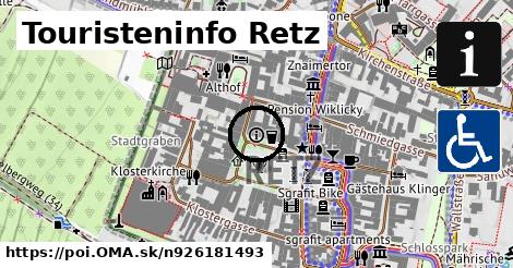
Obchod
Mühlberger Shoes & Bags ¤,
Weltladen Retz ¤,
Konditorei Wiklicky ¤,
Hair & More ¤,
Hartlauer ¤,
Bipa ¤,
Red Zac Reinhard Jäger ¤,
Hofer Buchhandlung ¤,
Laufsteg ¤,
oblečenie ¤,
IT Technik Streif ¤Stravovanie
Bürgermeisterstüberl ¤,
Konditorei Wiklicky ¤,
Gasthaus zur Stadt Retz ¤,
Stadtcafé Retz ¤,
Althof ¤,
Stadtheuriger Retz ¤,
Weinquartier ¤,
Elmer's Café ¤,
Pizzeria Alcapone ¤,
Schlossgasthaus ¤,
pitná voda ¤,
Gewölbeheuriger Fasching, Taberngasse 2, 2070 Retz ¤Služby
Stadtamt Retz ¤,
Standesamt Retz ¤,
toaleta ¤,
telefón ¤,
Raiffeisenkasse Retz-Pulkautal ¤,
Donnerbauer & Partner Rechtsanwalts GmbH ¤,
Polizeiinspektion Retz ¤,
Notar Mag. Harald Oppeck ¤,
Erste Bank ¤,
Immoplex ¤,
Volksbank ¤MHD v okolí
Bus 815: Retz Bahnhof = > Pfaffendorf Kirchenplatz = > Jetzelsdorf Kriegerdenkmal ¤,
Bus 815: Jetzelsdorf Kriegerdenkmal = > Pfaffendorf Franz-Ecker-Siedlung = > Retz Schulen = > Retz Bahnhof ¤,
Bus 875: Retz Bahnhof = > Weitersfeld im Waldviertel Hauptplatz ¤,
Bus 875: Weitersfeld im Waldviertel Hauptplatz = > Retz Bahnhof ¤,
Bus 888: Retz Bahnhof = > Horn Hauptplatz ¤,
Bus 876: Retz Bahnhof = > Pleißing Volksschule ¤,
Bus 876: Retz Bahnhof = > Mallersbach Ortsmitte ¤,
Bus 815: Kleinriedenthal Ort = > Retz Bahnhof ¤,
Bus 888: Horn Hauptplatz = > Retz Bahnhof ¤,
Bus 876: Retz Bahnhof = > Weitersfeld Hauptplatz = > Weitersfeld Schule ¤,
Bus 815: Retz Bahnhof = > Jetzelsdorf Kriegerdenkmal ¤Cyklotrasy v okolí
Thayatal Radweg ¤,
Weinradroute - Chardonnay ¤,
Weinviertel DAC Radtour ¤,
Wein und Kultur Radweg (abschnitt AT) ¤,
EuroVelo 13 - Cesta Železnej opony [AT|CZ]_5 (Slavonice - Hohenau an der March) ¤,
Weinviertler Kellergassen Radrunde ¤,
832 ¤,
830 ¤,
Reblausexpress Radweg ¤,
6 Städte Radtour ¤,
Kamp-Thaya-March Radroute ¤Viac o bode
Viac info:
aktualizovať mapu,
uprav v JOSM (pokročilé),
926181493,
stiahni GPX, phone: +43 2942 20010, informácie, website: https://www.retzer land.at/, addr:city: Retz, wheelchair: yes, addr:street: Hauptplatz, information: office, addr:country: AT, addr:postcode: 2070, 30, lon: 15.9505732, lat: 48.7574195, og type: place,
Zdroj dát
Mapové údaje pochádzajú z
www.OpenStreetMap.org, databáza je prístupná pod licenciou
ODbL.

Mapový podklad vytvára a aktualizuje
Freemap Slovakia (www.freemap.sk), šíriteľný pod licenciou CC-BY-SA. Fotky sme čerpali z galérie portálu freemap.sk, autori fotiek sú uvedení pri jednotlivých fotkách a sú šíriteľné pod licenciou CC a z wikipédie. Výškový profil trás čerpáme z
SRTM. Niečo vám chýba?
Pridajte to. Sme radi, že tvoríte slobodnú wiki mapu sveta.

 Mapový podklad vytvára a aktualizuje Freemap Slovakia (www.freemap.sk), šíriteľný pod licenciou CC-BY-SA. Fotky sme čerpali z galérie portálu freemap.sk, autori fotiek sú uvedení pri jednotlivých fotkách a sú šíriteľné pod licenciou CC a z wikipédie. Výškový profil trás čerpáme z SRTM. Niečo vám chýba? Pridajte to. Sme radi, že tvoríte slobodnú wiki mapu sveta.