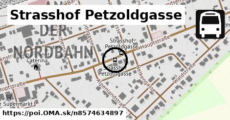
Cesta: OMA » Strasshof Petzoldgasse

Strasshof Petzoldgasse

Strasshof Petzoldgasse: autobusová zastávka,
Gemeinde Strasshof an der Nordbahn
Súradnice: 48°19'3"N, 16°38'44"E
Gemeinde Strasshof an der Nordbahn

Linky na zastávke

Bus 521: Deutsch-Wagram = > Gänserndorf Süd Volksschule ¤, Bus 521: Deutsch-Wagram = > Gänserndorf ¤, Bus 521: Deutsch-Wagram = > Gänserndorf Bahnhof ¤, Bus 521: Deutsch-Wagram = > Gänserndorf Bahnhof ¤, Bus 523: Schulcampus = > Anzengrubergasse ¤, Bus 523: Industriestraße = > Schulcampus ¤, Bus 523: Anton-Fromm-Gasse = > Schulcampus ¤, Bus 524: Strasshof Industriestraße = > Gänserndorf Busbahnhof ¤, Bus 532: Strasshof Lehárgasse = > Matzen Schule ¤

Obchod

remeslo ¤

Služby

Raiffeisenbank Strasshof ¤, remeslo ¤, remeslo ¤, remeslo ¤

Doprava

Strasshof Petzoldgasse ¤

Auto

parkovisko ¤

Zdravotníctvo

Balga Philipp Dr med ¤

Zastávky v okolí

Strasshof Petzoldgasse ¤, Strasshof Petzoldgasse ¤, Strasshof Anzengrubergasse ¤, Strasshof Anzengrubergasse ¤, Strasshof Billrothgasse ¤, Strasshof Billrothgasse ¤, Strasshof Girardigasse ¤

MHD v okolí

Bus 532: Matzen Schule = > Strasshof Lehargasse ¤, Bus 523: Schulcampus = > Anzengrubergasse ¤, Bus 523: Anton-Fromm-Gasse = > Schulcampus ¤, Bus 524: Strasshof Industriestraße = > Gänserndorf Busbahnhof ¤, Bus 521: Gänserndorf = > Deutsch Wagram ¤, Bus 532: Strasshof Lehárgasse = > Matzen Schule ¤, Bus 521: Deutsch-Wagram = > Gänserndorf Bahnhof ¤, Bus 523: Industriestraße = > Schulcampus ¤, Bus 521: Deutsch-Wagram = > Gänserndorf ¤, Bus 521: Gänserndorf = > Deutsch Wagram (nicht über Helmahof Andreas-Reischek-Gasse) ¤, Bus 521: Deutsch-Wagram = > Gänserndorf Bahnhof ¤

Cyklotrasy v okolí

Dampfross & Drahtesel Radroute ¤

V kategóriách

autobusová zastávka v Gemeinde Strasshof an der Nordbahn 56x

Viac o bode

Viac info: aktualizovať mapu, uprav v JOSM (pokročilé), 8574634897,
Súradnice: 48°19'3"N, 16°38'44"E
stiahni GPX, lon: 16.6456591, lat: 48.317715, og type: place, og locality: Gemeinde Strasshof an der Nordbahn,
Strasshof Petzoldgasse

Viac o nás

Podpor projekt OMA:

QR kód na túto stránku poi.oma.sk n8574634897

Spojte sa s nami na facebooku, zdieľajte túto stránku na Facebooku, na Twittri, alebo umiestnite odkaz na svoju stránku.

Ale hlavne doplňte dáta do Openstreetmap, články do wikipédie, ...

Zdroj dát

Mapové údaje pochádzajú z www.OpenStreetMap.org, databáza je prístupná pod licenciou ODbL. OMA logoMapový podklad vytvára a aktualizuje Freemap Slovakia (www.freemap.sk), šíriteľný pod licenciou CC-BY-SA. Fotky sme čerpali z galérie portálu freemap.sk, autori fotiek sú uvedení pri jednotlivých fotkách a sú šíriteľné pod licenciou CC a z wikipédie. Výškový profil trás čerpáme z SRTM. Niečo vám chýba? Pridajte to. Sme radi, že tvoríte slobodnú wiki mapu sveta.