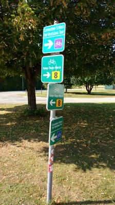
Cesta: OMA » Stopfenreuth Kirche

Stopfenreuth Kirche

Stopfenreuth Kirche: autobusová zastávka,
Engelhartstetten
Súradnice: 48°8'55"N, 16°52'50"E
Engelhartstetten

Linky na zastávke

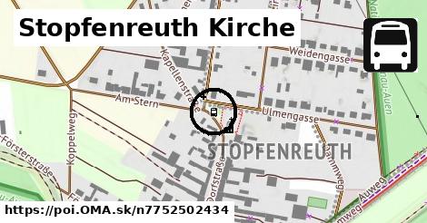
Bus 546: Stopfenreuth = > Engelhartstetten Volksschule ¤, Bus 546: Stopfenreuth = > Markthof ¤, Bus 546: Gänserndorf = > Stopfenreuth ¤, Bus 546: Markthof = > Stopfenreuth ¤, Bus 546: Engelhartstetten Volksschule = > Stopfenreuth ¤, Bus 546: Stopfenreuth = > Gänserndorf ¤, Bus 546: Stopfenreuth = > Loimersdorf Kirche = > Markthof ¤, Bus 546: Obersiebenbrunn Marktplatz = > Stopfenreuth ¤, Bus 546: Gänserndorf = > Markthof = > Stopfenreuth ¤, Bus 552: Stopfenreuth Uferstraße = > Großenzersdorf Busbahnhof ¤, Bus 552: Stopfenreuth Uferstraße = > Wien Aspernstraße ¤, Bus 552: Stopfenreuth Uferstraße = > Großenzersdorf Stadtmauer ¤, Bus 552: Stopfenreuth Uferstraße = > Orth an der Donau Biotech Campus = > Groß-Enzersdorf Busbahnhof ¤

Turistika

orientačný bod ¤, orientačný bod ¤

Voľný čas

park ¤

Služby

telefón ¤, kôš ¤, hasiči ¤

Doprava

Stopfenreuth Uferstraße ¤

Duchovno

cintorín ¤, kostol ¤, kostol ¤

Zastávky v okolí

Stopfenreuth Kirche ¤, Stopfenreuth Uferstraße ¤

MHD v okolí

Bus 546: Gänserndorf = > Stopfenreuth ¤, Bus 546: Stopfenreuth = > Engelhartstetten Volksschule ¤, Bus 546: Markthof = > Stopfenreuth ¤, Bus 552: Groß-Enzersdorf Busbahnhof = > Stopfenreuth Uferstraße ¤, Bus 546: Stopfenreuth = > Markthof ¤, Bus 552: Groß-Enzersdorf Stadtmauer = > Stopfenreuth Uferstraße ¤, Bus 552: Stopfenreuth Uferstraße = > Großenzersdorf Busbahnhof ¤, Bus 552: Stopfenreuth Uferstraße = > Großenzersdorf Stadtmauer ¤, Bus 546: Gänserndorf = > Markthof = > Stopfenreuth ¤, Bus 552: Stopfenreuth Uferstraße = > Wien Aspernstraße ¤, Bus 546: Stopfenreuth = > Loimersdorf Kirche = > Markthof ¤

Cyklotrasy v okolí

Longinus Radweg ¤, Kamp-Thaya-March Radroute ¤, Carnuntum - Schloss Hof - Bratislava Tour ¤

V kategóriách

autobusová zastávka v Engelhartstetten 19x

Viac o bode

Viac info: aktualizovať mapu, uprav v JOSM (pokročilé), 7752502434,
Súradnice: 48°8'55"N, 16°52'50"E
stiahni GPX, lon: 16.8805569, lat: 48.1486401, og type: place, og locality: Engelhartstetten,
Stopfenreuth Kirche

Viac o nás

Podpor projekt OMA:

QR kód na túto stránku poi.oma.sk n7752502434

Spojte sa s nami na facebooku, zdieľajte túto stránku na Facebooku, na Twittri, alebo umiestnite odkaz na svoju stránku.

Ale hlavne doplňte dáta do Openstreetmap, články do wikipédie, ...

Zdroj dát

Mapové údaje pochádzajú z www.OpenStreetMap.org, databáza je prístupná pod licenciou ODbL. OMA logoMapový podklad vytvára a aktualizuje Freemap Slovakia (www.freemap.sk), šíriteľný pod licenciou CC-BY-SA. Fotky sme čerpali z galérie portálu freemap.sk, autori fotiek sú uvedení pri jednotlivých fotkách a sú šíriteľné pod licenciou CC a z wikipédie. Výškový profil trás čerpáme z SRTM. Niečo vám chýba? Pridajte to. Sme radi, že tvoríte slobodnú wiki mapu sveta.