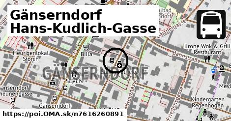
Cesta: OMA » Gänserndorf Hans-Kudlich-Gasse

Gänserndorf Hans-Kudlich-Gasse

Gänserndorf Hans-Kudlich-Gasse: autobusová zastávka,
Gemeinde Gänserndorf
Súradnice: 48°20'26"N, 16°43'10"E
Gemeinde Gänserndorf

Linky na zastávke

Bus 521: Gänserndorf = > Deutsch Wagram ¤, Bus 521: Gänserndorf = > Deutsch Wagram (nicht über Helmahof Andreas-Reischek-Gasse) ¤, Bus 524: Gänserndorf Hans-Kudlich-Gasse = > Strasshof Werndlgasse ¤, Bus 526: Gänserndorf Hans-Kudlich-Gasse = > Angern/March Bahnhof (ohne Dörfles) ¤, Bus 526: Ollersdorf Tallesbrunner Straße = > Gänserndorf Bbf ¤, Bus 526: Gänserndorf Hans-Kudlich-Gasse = > Ebenthal Stillfrieder Straße ¤, Bus 526: Angern Bahnhof = > Gänserndorf Bbf (ohne Dörfles) ¤, Bus 526: Angern Marktplatz = > Gänserndorf Bbf ¤, Bus 528: Gänserndorf Hans-Kudlich-Gasse = > Baumgarten/March Ortsmitte (ohne Halt in Gänserndorf Schillergasse, Grillparzergasse) ¤, Bus 528: Gänserndorf Hans-Kudlich-Gasse = > Markthof Nr. 10 ¤, Bus 528: Oberweiden Gemeindeamt = > Gänserndorf Busbahnhof ¤, Bus 528: Markthof Nr. 10 = > Gänserndorf Busbahnhof ¤, Bus 528: Gänserndorf Hans-Kudlich-Gasse = > Baumgarten/March Ortsmitte ¤, Bus 528: Gänserndorf Hans-Kudlich-Gasse = > Weikendorf Volksschule (ohne Halt in Gänserndorf Schillergasse, Grillparzergasse) ¤, Bus 531: Auersthal Schulen = > Gänserndorf Bahnhof ¤, Bus 531: Auersthal Schulen = > Gänserndorf Bahnhof (über Schönkirchen Volksschule) ¤, Bus 531: Wolkersdorf Gymnasium = > Gänserndorf Bahnhof ¤, Bus 531: Wolkersdorf Gymnasium = > Gänserndorf Bahnhof (über Auersthal Europa-Siedlung) ¤, Bus 534: Gänserndorf Bahnhof = > Zistersdorf Schloßplatz ¤, Bus 535: Gänserndorf Bahnhof = > Mistelbach Bahnhof ¤, Bus 535: Gänserndorf Bahnhof = > Mistelbach Bahnhof ¤, Bus 535: Mistelbach Bahnhof = > Gänserndorf Bahnhof ¤, Bus 536: Gänserndorf Bahnhof = > Spannberg Hauptplatz ¤, Bus 536: Gänserndorf Bahnhof = > Dürnkrut Bahnhof ¤, Bus 537: Gänserndorf Bahnhof = > Matzen Schule ¤, Bus 537: Gänserndorf Bahnhof = > Dürnkrut Bahnhof ¤, Bus 537: Gänserndorf Bahnhof = > Ebenthal Stillfrieder Straße (Halt in Gänserndorf OMV) ¤, Bus 537: Gänserndorf Bahnhof = > Ebenthal Stillfrieder Straße ¤, Bus 537: Gänserndorf Bahnhof = > Ebenthal Stillfrieder Straße (ohne Matzen) ¤, Bus 545: Gänserndorf = > Orth/Donau ¤, Bus 545: Gänserndorf = > Haringsee ¤, Bus 546: Gänserndorf = > Stopfenreuth (via Markthof) ¤, Bus 546: Gänserndorf = > Stopfenreuth ¤

Obchod

Billa ¤, Möbelhaus Karner ¤, Freestyle Friseur ¤, miss chic ¤, Bauer ¤, Brigitte ¤, Palmers ¤, Goldschmiede & Antiquitäten Maczek ¤, Legerer ¤, Kirchmeyer ¤, street one ¤

Ubytovanie

Gasthof Prager ¤

Stravovanie

Gasthof Prager ¤, SEVEN ¤, Schnitzelhaus Gänserndorf ¤, Cafe Ente Pub ¤, Vitavien ¤, Plazebo ¤, Geier’s Gambrinus ¤

Turistika

prístrešok, altánok ¤, Der Halterberg ¤

šport

Alter Turnsaal ¤, Regionalbad Gänserndorf ¤, Stadthalle Gänserndorf ¤, NINJA WARRIOR PARK Gänserndorf ¤, detské ihrisko ¤

Voľný čas

miesto na uviazanie psov ¤, Alter Turnsaal ¤, park ¤, park ¤

Služby

Allianz ¤, Raiffeisenbank ¤, kôš ¤, kôš ¤, Legerer ¤, Finanzamt Gänserndorf Mistelbach ¤, kôš ¤, kôš ¤, kôš ¤, kôš ¤, kôš ¤, kôš ¤, kôš ¤, kôš ¤, kôš ¤, bank99 ¤, kôš ¤, Post Filiale 8224 ¤, kôš ¤, Wiener Städtische ¤, Stadtamt Gänserndorf ¤, kôš ¤, kôš ¤, kôš ¤, kôš ¤, toaleta ¤, kôš ¤

Doprava

Gänserndorf Kirchenplatz ¤, Gänserndorf Rathausplatz ¤, Gänserndorf Rathausplatz ¤

Auto

parkovisko ¤, parkovisko ¤, parkovisko ¤, parkovisko ¤, parkovisko ¤, parkovisko ¤, parkovisko ¤, parkovisko ¤, parkovisko ¤, nabíjacia stanica ¤, parkovisko ¤, parkovisko ¤, parkovisko ¤, parkovisko ¤, nabíjacia stanica ¤, parkovisko ¤, parkovisko ¤, parkovisko ¤

Zdravotníctvo

Stadtapotheke ¤, Sanitätshaus | Orthopädietechnik Luksche ¤, Tierarztpraxis Palme ¤

Duchovno

Stadtpfarrkirche Zu den Heiligen Schutzengeln ¤, kaplnka ¤, Mevlana ¤

Príroda

Halterberg ¤

Vodné radosti

Regionalbad Gänserndorf ¤

Vzdelanie

NNÖMS Gänserndorf ¤, Handelsschule und Handelsakademie Gänserndorf ¤

Pamiatky

pamätník ¤

Bicykel

miesto na uviazanie psov ¤, cyklostojan ¤, cyklostojan ¤, cyklostojan ¤, cyklostojan ¤, cyklostojan ¤, cyklostojan ¤

Prevádzkovateľ

Billa ¤

Prístupnosť

Stadtapotheke ¤, parkovisko ¤, Billa ¤, Stadtpfarrkirche Zu den Heiligen Schutzengeln ¤, Geier’s Gambrinus ¤, Stadthalle Gänserndorf ¤

Zastávky v okolí

Gänserndorf Hans-Kudlich-Gasse ¤, Gänserndorf Kirchenplatz ¤, Gänserndorf Rathausplatz ¤, Gänserndorf Rathausplatz ¤, Gänserndorf Schönkirchner Straße ¤, Gänserndorf Schönkirchner Straße ¤, F ¤, E ¤, A ¤, D ¤, Busbahnhof Gänserndorf ¤, C ¤, B ¤, Gänserndorf Scheunengasse ¤, Gänserndorf Augasse ¤, Gänserndorf Augasse ¤, Gänserndorf B8/Kino-Steg ¤, Gänserndorf Sportgasse ¤, Gänserndorf Gärtnergasse ¤, Gänserndorf Volksschule ¤

MHD v okolí

Bus 535: Gänserndorf Bahnhof = > Mistelbach Bahnhof ¤, Bus 524: Gänserndorf Volksschule = > Strasshof Werndlgasse (über Gänserndorf Süd Eschenweg) ¤, Bus 545: Orth/Donau = > Gänserndorf ¤, Bus 537: Gänserndorf Bahnhof = > Matzen Schule ¤, Bus 528: Oberweiden Gemeindeamt = > Gänserndorf Busbahnhof ¤, Bus 531: Wolkersdorf Gymnasium = > Gänserndorf Bahnhof (über Auersthal Europa-Siedlung) ¤, Bus 545: Gänserndorf = > Orth/Donau ¤, Bus 524: Gänserndorf Volksschule = > Strasshof Werndlgasse ¤, Bus 528: Markthof Nr. 10 = > Gänserndorf Busbahnhof ¤, Bus 537: Gänserndorf Bahnhof = > Ebenthal Stillfrieder Straße (Halt in Gänserndorf OMV) ¤, Bus 546: Stopfenreuth = > Gänserndorf ¤

Cyklotrasy v okolí

5 Laa and der Thaya - Orth and der Donau ¤

V kategóriách

autobusová zastávka v Gemeinde Gänserndorf 64x

Viac o bode

Viac info: aktualizovať mapu, uprav v JOSM (pokročilé), 7616260891,
Súradnice: 48°20'26"N, 16°43'10"E
stiahni GPX, lon: 16.7195707, lat: 48.3407213, og type: place, og locality: Gemeinde Gänserndorf,
Gänserndorf Hans-Kudlich-Gasse

Viac o nás

Podpor projekt OMA:

QR kód na túto stránku poi.oma.sk n7616260891

Spojte sa s nami na facebooku, zdieľajte túto stránku na Facebooku, na Twittri, alebo umiestnite odkaz na svoju stránku.

Ale hlavne doplňte dáta do Openstreetmap, články do wikipédie, ...

Zdroj dát

Mapové údaje pochádzajú z www.OpenStreetMap.org, databáza je prístupná pod licenciou ODbL. OMA logoMapový podklad vytvára a aktualizuje Freemap Slovakia (www.freemap.sk), šíriteľný pod licenciou CC-BY-SA. Fotky sme čerpali z galérie portálu freemap.sk, autori fotiek sú uvedení pri jednotlivých fotkách a sú šíriteľné pod licenciou CC a z wikipédie. Výškový profil trás čerpáme z SRTM. Niečo vám chýba? Pridajte to. Sme radi, že tvoríte slobodnú wiki mapu sveta.