Cesta: OMA » Hollern Kirche
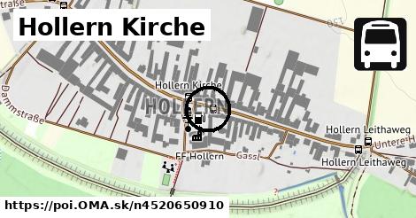
Hollern Kirche
Linky na zastávke
Bus 275: Pachfurth Kapelle = > Hollern Leithaweg ¤, Bus 275: Bruck/Leitha Bahnhof = > Hainburg/Donau Landesklinikum (über Hollern Dammstraße, Deutsch Haslau Obere Hauptstraße, Prellenkirchen Dt. Altenburger Straße) ¤, Bus 275: Bruck/Leitha Bahnhof = > Potzneusiedl Untere Hauptstraße ¤, Bus 275: Bruck/Leitha Bahnhof = > Prellenkirchen Ortsmitte ¤, Bus 275: Bruck/Leitha Gymnasium/HAK = > Hainburg/Donau Landesklinikum (über Hollern Dammstraße, Deutsch Haslau Obere Hauptstraße, Prellenkirchen Dt. Altenburger Straße) ¤, Bus 275: Bruck/Leitha Bahnhof = > Bad Deutsch-Altenburg Bahnhof ¤, Bus 275: Bruck/Leitha Bahnhof = > Potzneusiedl Untere Hauptstraße (über Prellenkirchen Volksschule) ¤, Bus 275: Bruck/Leitha Bahnhof = > Schönabrunn Teichrinne ¤Zastávky v okolí
Hollern Kirche ¤, Hollern Kirche ¤, Hollern Leithaweg ¤, Hollern Leithaweg ¤, Hollern Dammstraße ¤, Hollern Dammstraße ¤MHD v okolí
Bus 275: Bruck/Leitha Bahnhof = > Bad Deutsch-Altenburg Bahnhof ¤, Bus 275: Potzneusiedl Untere Hauptstraße = > Bruck/Leitha Bahnhof (über Rohrau Untere Hauptstraße, Pachfurth Milchgasse und Pachfurth Bahnstraße) ¤, Bus 275: Hainburg Josef-Maurer-Gasse = > Bruck/Leitha Gymnasium/HAK ¤, Bus 275: Potzneusiedl Untere Hauptstraße = > Bruck/Leitha Bahnhof ¤, Bus 275: Hainburg/Donau Landesklinikum = > Bruck/Leitha Bahnhof (über Rohrau Untere Hauptstraße, Pachfurth Milchgasse und Pachfurth Bahnstraße) ¤, Bus 275: Bruck/Leitha Gymnasium/HAK = > Hainburg/Donau Landesklinikum (über Hollern Dammstraße, Deutsch Haslau Obere Hauptstraße, Prellenkirchen Dt. Altenburger Straße) ¤, Bus 275: Potzneusiedl Untere Hauptstraße = > Rohrau Untere Hauptstraße ¤, Bus 275: Hainburg/Donau Landesklinikum = > Bruck/Leitha Bahnhof (über Pachfurth Bahnstraße) ¤, Bus 275: Pachfurth Kapelle = > Hollern Leithaweg ¤, Bus 275: Bruck/Leitha Bahnhof = > Potzneusiedl Untere Hauptstraße ¤, Bus 275: Bruck/Leitha Bahnhof = > Potzneusiedl Untere Hauptstraße (über Prellenkirchen Volksschule) ¤V kategóriách
autobusová zastávka v Rohrau 21xViac o bode
Viac info: aktualizovať mapu, uprav v JOSM (pokročilé), 4520650910, stiahni GPX, najbližšia MHD, lon: 16.8946079, lat: 48.075193, og type: place, og locality: Rohrau,Podpor projekt OMA:

Spojte sa s nami na facebooku, zdieľajte túto stránku na Facebooku, na Twittri, alebo umiestnite odkaz na svoju stránku.
Ale hlavne doplňte dáta do Openstreetmap, fotky do Freemap galérie, články do wikipédie, ...
Zdroj dát
Mapové údaje pochádzajú z www.OpenStreetMap.org, databáza je prístupná pod licenciou ODbL.