Turistika
turistické informácie ¤,
turistické informácie ¤,
turistické informácie ¤,
turistické informácie ¤,
turistické informácie ¤,
turistické informácie ¤,
turistické informácie ¤,
turistické informácie ¤,
turistické informácie ¤,
orientačný bod ¤,
turistické informácie ¤,
turistické informácie ¤,
turistické informácie ¤,
turistické informácie ¤,
turistické informácie ¤,
turistické informácie ¤,
turistické informácie ¤,
turistické informácie ¤MHD v okolí
Bus 273: Neusiedl am See Hauptplatz = > Fischamend Bahnhof = > Flughafen Wien Busterminal ¤,
Bus 273: Neusiedl am See Schulzentrum = > Neusiedl am See Pannonia Shopping Park = > Fischamend Bahnhof = > Flughafen Wien Busterminal ¤,
EN 40467: Zürich = > Budapest ¤,
REX6: Deutschkreutz = > Wien = > Bratislava ¤,
ICE 90: Budapest → München ¤,
Bus 273: Neusiedl am See Hauptplatz = > Neusiedl am See Pannonia Shopping Park = > Fischamend Bahnhof ¤,
Bus 273: Neusiedl am See Schulzentrum = > Bruck an der Leitha Bahnhof ¤,
Bus 273: Neusiedl am See Hauptplatz = > Neusiedl am See Pannonia Shopping Park = > Flughafen Wien Busterminal ¤,
Відень-Київ ¤,
EN 462: Budapest = > München ¤,
REX64: Wien = > Bruck an der Leitha = > Wulkaprodersdorf ¤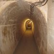
Viac o bode
Viac info:
aktualizovať mapu,
uprav v JOSM (pokročilé),
2772906018,
stiahni GPX,
wikidata, múzeum, building: bunker, bunker, wikipedia: de:Bunkeranlage Ungerberg, bunker type: troops crew bunker, opening hours: closed, Category:Bunkeranlage Ungerberg, lon: 16.8153932, lat: 48.0125272, og type: place, og locality: Gemeinde Bruckneudorf,
Zdroj dát
Mapové údaje pochádzajú z
www.OpenStreetMap.org, databáza je prístupná pod licenciou
ODbL.

Mapový podklad vytvára a aktualizuje
Freemap Slovakia (www.freemap.sk), šíriteľný pod licenciou CC-BY-SA. Fotky sme čerpali z galérie portálu freemap.sk, autori fotiek sú uvedení pri jednotlivých fotkách a sú šíriteľné pod licenciou CC a z wikipédie. Výškový profil trás čerpáme z
SRTM. Niečo vám chýba?
Pridajte to. Sme radi, že tvoríte slobodnú wiki mapu sveta.


